|
|
November, 1957
The Orbitometer
The Orbitometer was a "satellite orbit slide rule" devised as a shortcut to get around the
laborious calculations performed by various members of the St Joe's High School Radio Club
to predict the orbits starting with the very first Sputnik satellites.
This was an amazing achievement in the context
of the era! They started working on a patent, and two companies were considering manufacturing the device.
Keep in mind that affordable electronic calculators had not been invented yet. Engineers and Scientists
did all their work using linear "slide rules" and books of tables laboriously worked out
by paper calculations, and using mechanical calculators.
Instructions for use of
The Orbitometer
(retyped and edited from the photographed instructions)
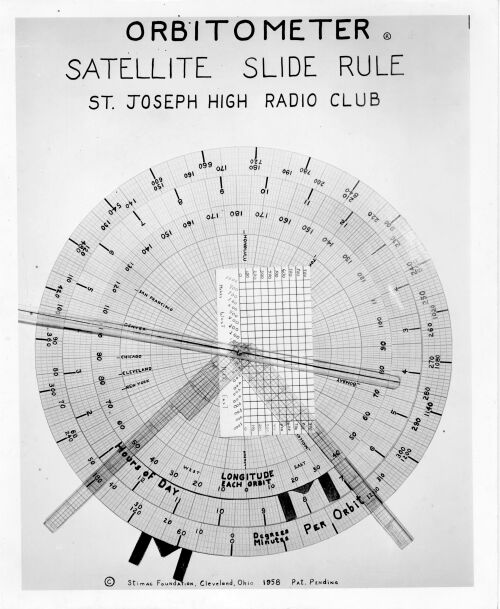
The ORBITOMETER
is a circular slide rule, differing from most
in that you mark certain intervals on one part, and use these marks
for particular satellites. The rule can then be set to these marks
and will indicate when and where the satellite will pass by your city
due east or west, for the rest of the day.
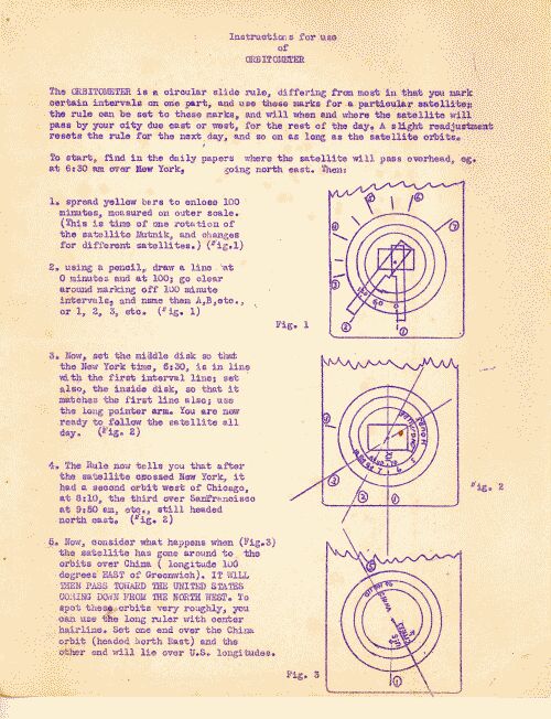
To start, find in the papers where the satellite will pass overhead, eg.
at 6:30 am over New York, going north east. Then:
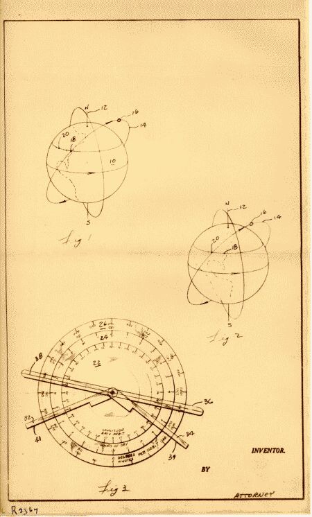
1) Spread the yellow bars to enclose 100 minutes, measured on the outer scale.
(This is the time of Sputnik-2, nicknamed "Muttnik," because of the dog Laika on board,
and changes for different satellites.)
(Fig. 1)
(Lacking the above information, one can start by making direct observations,
recording the times, and reference points, for several actual passes of the satellite;
set that into the Orbitometer and make refinements as more passes are accumulated.
But for now, let's go back to using our example.)
2) Using a pencil, draw a line at 0 minutes and at 100 minutes (we're talking about
minutes of time here not minutes of angilar degrees).
Continue clear around marking off 100 minute intervals, and name them A,B, etc., or 1,2,3, etc.
(Fig 1)
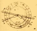
3) Now set the middle disk so that the New York Time, 6:30 is in line with the first
interval line; set also the inside disk so that it matches the first line; use the long
pointer arm. You are now ready to follow the satellite all day. (Fig.2)
4) The Rule now tells you that after the satellite crossed New York, it had a
second orbit west of Chicago at 8:10, the third over San Francisco 1t 9:50 am, etc.
still headed north east. (Fig. 2)
5) Now consider what happens when (Fig. 3) the satellite has gone around to the
orbits over China (longitude 100 degrees East of Greenwich). IT WILL THEN PASS TOWARD
THE UNITED STATES COMING DOWN FROM THE NORTH WEST. To spot these orbits very
roughly, you can use the ruler with center hairline. Set one end over the China
orbit (headed North East) and the other end will lie over the U.S. longitudes.
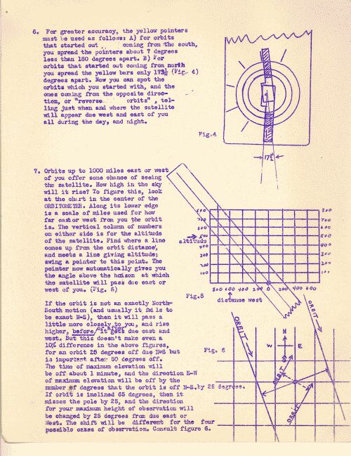
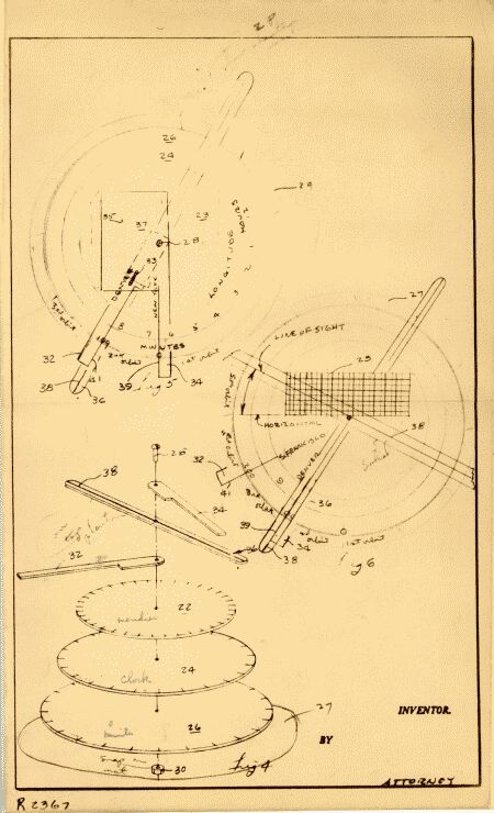
6) For greater accuracy, the yellow pointers must be used as follows:
A) for orbits that
started out coming from the South, you spread the the pointer about 7 degrees less than 180
degrees apart.
B) For orbits that started out coming from the North you
spread the the yellow bars only 173.5 (Fig. 4) degrees apart. Now you can spot
the orbits which you started with, the one's coming from the opposite direction, or
"reverse orbits", telling just when and where the satellite will appear due west and
east of you all during the day, and night.
7) Orbits of up to 1000 miles east or west of you offer some chance of you being able
to see the satellite. How high in the sky will it rise? To calculate
this, look at the chart in the center of the ORBITOMETER. Along its lower edge is a scale
of miles used for how far east or west from you the orbit is. The vertical
column of numbers on either side is the altitude of the satellite. Find where
a line comes up from the orbit distance and meets the line giving altitude; swing a
pointer to this point. The pointer now automatically gives you the angle
above the horizon at which the satellite will pass due east or west of you. (Fig. 5)
If the orbit is not exactly a North-South motion (which is usually the case), then it will
pass a little more closely to you, and rise higher, before or after it gets due east
and west. But this does not make even a 10% difference in the above figures,
for an orbit 25 degrees off due N-S, but is important after 50 degrees off.
The time of maximum elevation will be off by about 1 minute, and the direction E-W of
maximum elevation will be off by the number of degrees that the orbit is off N-S, by 25
degrees. If the orbit is inclined 65 degrees, then it misses the pole by 25
degrees, and the direction of the maximum height of observation will be changed by 25
degrees from due East or West. The shift will be different for the four possible
cases of observation. Consult Figure 6.
There you go! See how simple it is! --and it was all figured out by a bunch of
15-year-olds, 60 years ago! We're sure glad we wrote that all down back then, because we
don't think we could remember it now!
|
|